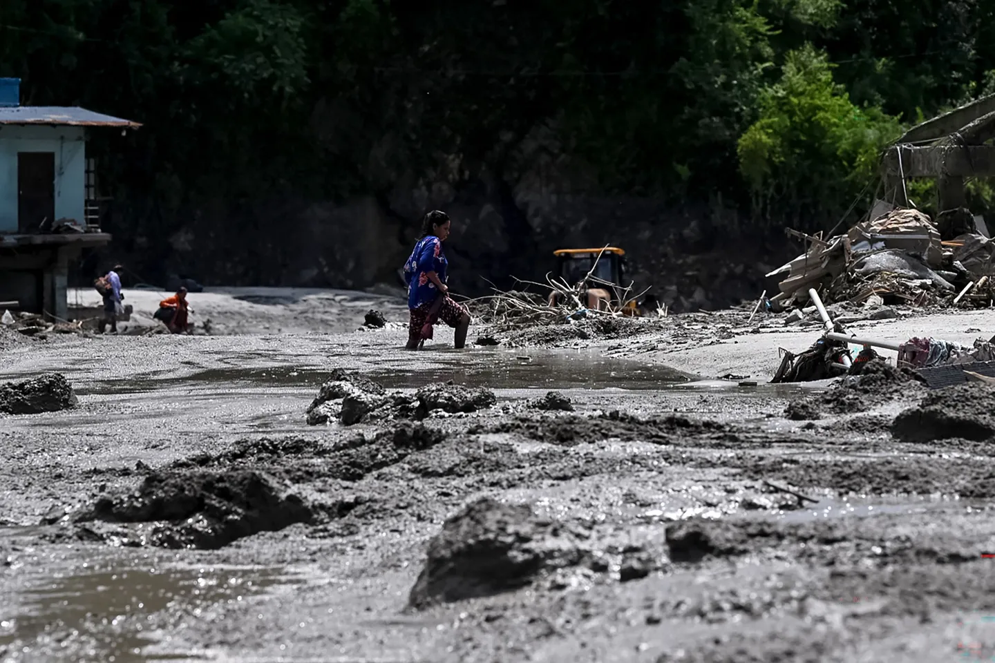
The death toll from devastating floods in Nepal has risen to 469, according to figures on Friday from The Kathmandu Post.
China confirmed three deaths in the southwestern Xizang Autonomous Region, also known as Tibet, bringing the total death toll to 472.
A total of 667 people, including foreign nationals, were missing in Nepal as of late Thursday, according to the Nepal Tourism Board. Beijing said more than 550 people, including 260 foreign nationals, are unaccounted for in Tibet.
The floods and landslides struck northern and central Nepal early on Wednesday, sweeping through communities along the Bhotekoshi and Trishuli rivers, and carrying people and debris downstream.
It swept away homes, bridges, roads and other infrastructure, while leaving communities and travellers cut off from the rest of the country.
Search and rescue teams are continuing operations, with the Nepali army, police and armed police force deployed for search, rescue and evacuation efforts.
Helicopters have been used to reach isolated areas and evacuate survivors, while ground teams continue searching riverbanks and downstream settlements.
The tourism board said it was continuing to verify the whereabouts of tourists and travellers who were in or passing through Rasuwa, Nuwakot and Dhading when the floods struck.
The floods also severely damaged transport links and other infrastructure, complicating rescue efforts in affected areas.
The extent of the disaster remained unclear as authorities continued to reconcile casualty and missing person reports from different areas.
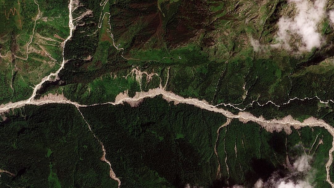
China rushes to minimise risk from lakes formed by glacier debris near Nepal border
China, meanwhile, is racing to reduce the risk of more flooding at the disaster-stricken border crossing linking its Tibet region to Nepal.


Nepal and China both warned on Thursday of fresh risks of flooding in the Himalayas, with debris dams which created two barrier lakes on either side of their border threatening to collapse.
Chinese authorities have mobilised an eight-member engineering team to conduct aerial surveys and 3D modelling of the barrier lake, according to state broadcaster CCTV on Friday.
One of the engineers, Chen Hanxiao, said challenges included difficult access to the site.
"After the glacier collapse created the lake, many isolated cliffs and steep cliffs appeared along it," Chen told CCTV on Thursday evening.
Chen said the general approach to reducing the lake's threat is to excavate a drainage channel at a lower point of the dam but the width and depth of that channel needed calculations based on how fast the water will flow and how quickly the lake will fill.
Data from their survey found that the lake was about 150 metres long and 40-50 metres deep with a reservoir of 1.5-2 million cubic metres of water.
Their next tasks were to monitor the lake and collect data from the lake floor, as well as weather monitoring in the coming days.
The Gyirong border port area has seen light to moderate rainfall which has loosened and destabilised soil and rock surrounding the precarious zone upstream. The rain is forecast to continue over the coming week.
China on Thursday warned that 3 million cubic metres of water — the equivalent of about 1,200 Olympic swimming pools — are expected to flow into the still-dammed lake over the next three days, creating a high risk of a breach, with peak flow expected around September 1.
The formation of a barrier lake was captured in aerial footage by a Chinese rescue team shown by state broadcaster CGTN. It showed masses of brown water accumulating in a basin with no visible outlet, that had already submerged bushes and trees and appeared to push against a barrier of debris and stones.